

Showing posts with label Electric Hospital. Show all posts
Showing posts with label Electric Hospital. Show all posts
Wednesday, April 18, 2012
Long Arm in the West
The Roseburg Quilt Guild had a fun show at the Douglas County Fair grounds. Maria and I attended as vendors representing the Electric Hospital. We had fun meeting the talented artists. Maria wrote about this in her Blog "A Maria Kind of Day." You can follow the link here. We displayed our long arm quilting machines. The sit down Tin Lizzie 18 has a large sturdy table with a leaf for free-motion quilting. The Tin Lizzie 18 DLS has an adjustable frame with a built in stitch regulator. The faster you quilt the faster the machine sews. This makes all the stitches the same length. The newest addition to the the Tin Lizzie 18 line is the ESP with the Quilt Magician. This 12 foot frame will permit you to quickly and precisely quilt a large quilt. The Quilt Magician is a quilting robot that allows you to place any fabulous design exactly where you want it and the magic happens without you even touching the machine.

Sunday, November 8, 2009
Fall storm on the Oregon Coast
Too Big for me.

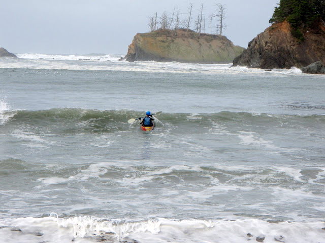
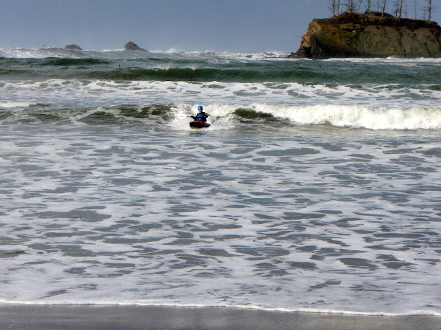
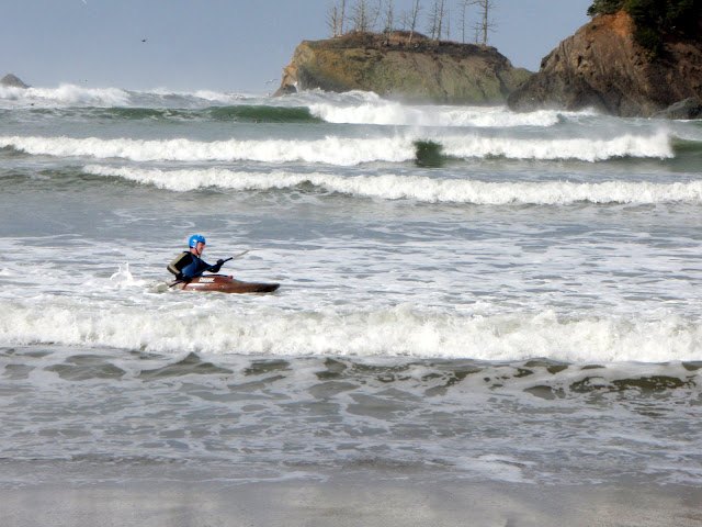
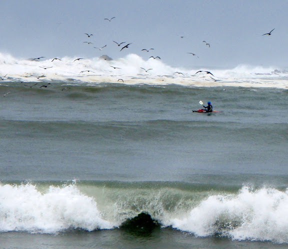
Pete wanted to do a little short notice surfing inside Sunset Bay. The weather forecast was for small craft advisory. I had an open canoe on the roof of my car and tossed a wet suit in the car with my regular kit. I checked out the wave issue on the coast for myself and decided an open canoe was not safe to play in. Pete on the other hand had his kayak and helmet with a number of years more surfing experience than me.
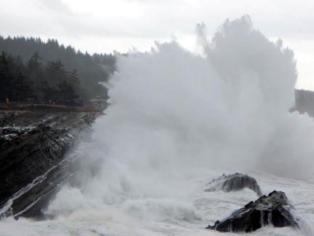
This is a view of Shore Acres State Park. You can see the people standing on the far left. It gives a good idea of the scale of these huge waves.
The view after the wave.
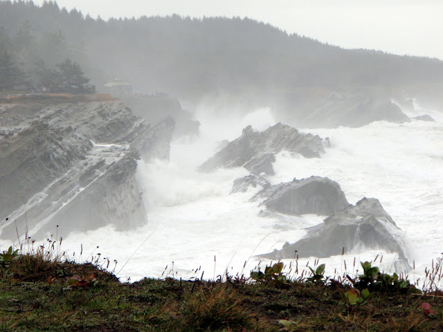
This is a great spot as the waves explode when the air gets trapped against the tilted rocks.
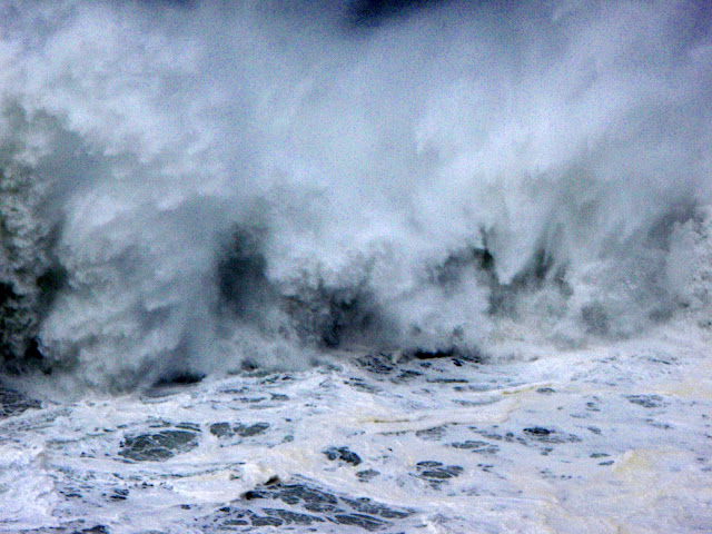
This was not a place for any boat.
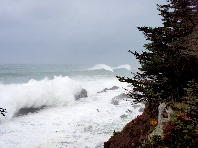
Behind these rocks is Sunset Bay. It is protected by some rocks and the island with the dead trees on it.
Inside the bay the waves were confused. Multiple breaks were all over the bay and moved frequently.


This is a view of Shore Acres State Park. You can see the people standing on the far left. It gives a good idea of the scale of these huge waves.
The view after the wave.
This is a great spot as the waves explode when the air gets trapped against the tilted rocks.
This was not a place for any boat.
Behind these rocks is Sunset Bay. It is protected by some rocks and the island with the dead trees on it.
Inside the bay the waves were confused. Multiple breaks were all over the bay and moved frequently.


Even if it was too big for my open canoe it was a great day to enjoy a fall storm on the Oregon coast.

Friday, August 14, 2009
Sewing Machine Repair
I hear this frequently at my store, "my sewing machine just needs a tension
adjustment as it is making loops on the back of my fabric."
Many times it is not a tension problem. Here is a link to a you tube slide show
I created I hope it will help someone that is having tension problems that do
not go away with tension adjustments. This was done on a long arm quilting machine the Tin Lizzie 18 LS but the theory is the same for other machines.
Sewing machine basic adjustments.

What a great place to live
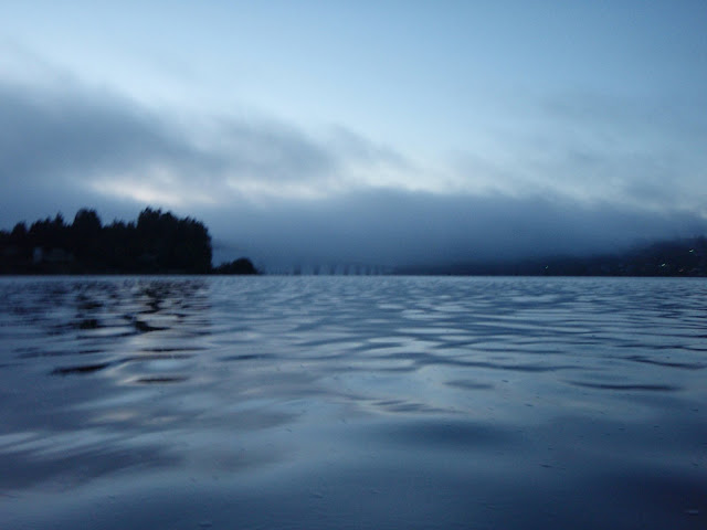
I was at work at 7:00 P. M. and decided I should take advantage of the nice evening. I drove home and by 7:36 had taken my first picture from on the water. 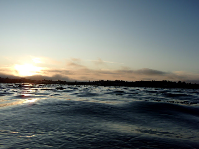
I could see the fog drifting in from the ocean and headed towards the North Bend Bridge for a picture or two.
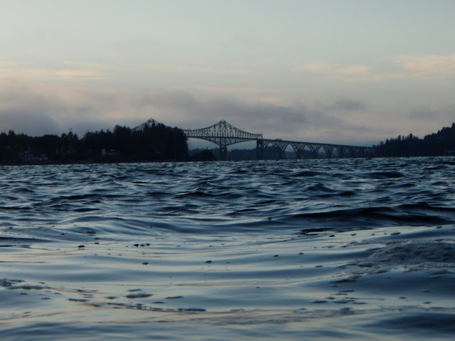
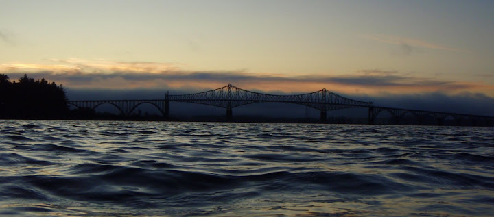
The colors kept changing as the sun set. It was hard to shoot at low shutter speed from a rocking canoe.

Artsy shot.
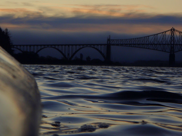
The fog became thicker and swallowed the bridge.
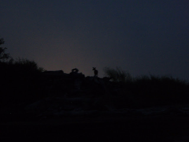
As I came back a doe and fawn were on the skyline inside the city.
It was a great 2 hour paddle.
__________________

Dr. Joe
(The appliance Doctor)
Electric Hospital
Coos Bay, Oregon
541-267-2241
Dr. Joe
(The appliance Doctor)
Electric Hospital
Coos Bay, Oregon
541-267-2241

Monday, July 13, 2009
Two Days on the John Day River
My trip was shortened from one week and 115 miles to two days and 47 miles. We put in on the John Day at Service Creek.
The John Day is over 300 miles with no dams. It begins in the Ocheco Mountains and Blue Mountains. I drove up from the Columbia after visiting my grand children in Richland Wa. My son in law got off work and we drove the 4 hours to the take out. Pitching the tent in the dark desert was not a problem until at sunrise I realized the tent was swarmed with fire ants. Fortunatly the sewed in floor and bug nets did a very good job. Only 2 of the hundreds of ants made it into the tent. It was a more powerful wake up than an alarm clock. I jumped out of my sleeping bag and at 4:30 was ready to get on the river.

Sunrise at Clarno Bridge with my inverted SOTP shot.
We left one rig and drove to Service Creek at river mile 157.

I did a few experiments on this trip. I copied the images from Google Earth of the river I wanted to run. I could not figure how to print the entire river at the scale I wanted so using alt prntscreen I pasted the images to a Publisher file, with one image per page. Then I was able to put notes from two other river guides along with the river miles, powerlines, rapids and camp sites. I thought it would be great to have a photo from canoe level of the entrance to the major rapids.

Russo Rapids Class II from Google Earth. I was very pleased with my map. I could even tell where the main channel was from the arial photos.

This section is not as remote or steep as it is further down the river. It drops 8 feet per mile and 11 feet per mile further down. There were farms where the soil was not too steep or rocky. This horse ranch was beautiful with a large home overlooking his foals.

This little lizzard was along the shore but he would not pose with the big rocks in the background like I wanted.

There were thousands of swallow burrows in the soft cliffs. I noticed some even eroded the banks.

These poor ospreys were being bullied by the tiny red winged blackbird. It hit the nesting bird in the back while it sat on its eggs minding its own business. I also saw them chassing a blue heron and other ospreys.

As you descend the river you are going back in time, as the river cuts deeper into the painted desert. It was great to travel with my son in law the geologist. He had more information than I can recall about what time span we were seeing and where the bands of ash came from and what geological period.

I thought this looked like a cinder cone but Jake says it is erosion instead.

This is the entrance to Burnt Ranch Rapids Class III. I put a bolt in the end of a trecking pole and mounted my camera on the end before the trip. Then I lashed it to the stern and tied the camera to the hull just as a precaution in case of a capsize.
I let Jake scout this rapid while I made my camera mount. For a first attempt this worked ok. I put the camera a little too low. But the worst part was the best video I deleted hence I only have the smaller Lower Burnt Ranch Rapid Class II.

This was one of may unique un-named formations.

Our first camp site near Rattlesnake Creek mile 122. I was hoping to get a picture of a rattlesnake and brought my high top boots and trecking pole as a snake stick. Two miles of hiking and no live snakes I was a little disappointed. After 35 miles of paddling I was too tired to search longer. Before sunset I was asleep.

I liked this tiny flower tucked away between the sharp spines of a cacti.

There were several camp sites but we had the river this night all to ourself. I was very pleased that the previous users had left no garbage other than a few charred sticks. We left no trace for the next users.

Jake is fashionable dressed in a garbage bag instead of his London Fog.

Here is my SOTP shot. I looked at a lot of scenery to get this image.

I found these basalt columns impressive.

These ancient rock paintings are not easy to find as those that know where they are will not tell strangers that may damage them. I am not telling either.

I wish I could interpret these. I read that they were frequently next to a good food gathering site. It did look like a perfect spot for an ambush of animals going to the river to drink.

This one looked like a hand print that said I was here.

It looks like this was the paint sticks used.

This is a band of ash from the mountain that created Crater Lake according to Jake.

Sometimes you wonder who put that big rock in the middle of the river?

Jakes is wearing his sun protecting shirt and hat to beat the desert sun. Note my navigation table with compass on the the wet bag. I could tell from the color pictures on the map that matched the hills color.

We saw these caves and climbed up to see them closer.

This cave was only a few dozen yards deep. The floor was deep with sharp shards that had fallen from the ceiling. Since there were many more loose rocks above our heads we felt it prudent to not stay too long. I wonder what creatures were buried under our feet.

The coyotes had recently eaten a blue bird in one of the caves.

This colorful cliff was full of stones glued together with some sort of ash and mud flow.

There were numerous large families of geese and they were quite unafraid. I suspect they do not see much hunting pressure.
The painted desert with the growing thunderstorm made me pull over and get the video camera out of the river bag. While waiting for a big bolt of lightning I spied an osprey. It was a real challenge to keep it in the viewfinder. The auto-focus was confused by all the changes as I spun in circles. At one point I had to stop looking in the viewfinder to keep my balance.
This osprey was having a bad day. A pair of red winged black birds gave this osprey a rough time. Then when it caught the biggest fish of its life its eyes were bigger than its wings and it could not take off. Before and after it got airborne the black birds were on the attack again. Nature is such a trip.

Instead of driving back the Columbia river I wanted to see the headwaters in the Ochoco Mountains where there is more painted desert.

John Day Fossil Beds National Park has three separate sections one is the painted desert.

As I climbed up the mountains you change from desert to lush green big pine forests.
It was a short trip but a great way to spend two days seeing a different side of Oregon.
The John Day is over 300 miles with no dams. It begins in the Ocheco Mountains and Blue Mountains. I drove up from the Columbia after visiting my grand children in Richland Wa. My son in law got off work and we drove the 4 hours to the take out. Pitching the tent in the dark desert was not a problem until at sunrise I realized the tent was swarmed with fire ants. Fortunatly the sewed in floor and bug nets did a very good job. Only 2 of the hundreds of ants made it into the tent. It was a more powerful wake up than an alarm clock. I jumped out of my sleeping bag and at 4:30 was ready to get on the river.
Sunrise at Clarno Bridge with my inverted SOTP shot.
We left one rig and drove to Service Creek at river mile 157.
I did a few experiments on this trip. I copied the images from Google Earth of the river I wanted to run. I could not figure how to print the entire river at the scale I wanted so using alt prntscreen I pasted the images to a Publisher file, with one image per page. Then I was able to put notes from two other river guides along with the river miles, powerlines, rapids and camp sites. I thought it would be great to have a photo from canoe level of the entrance to the major rapids.
Russo Rapids Class II from Google Earth. I was very pleased with my map. I could even tell where the main channel was from the arial photos.
This section is not as remote or steep as it is further down the river. It drops 8 feet per mile and 11 feet per mile further down. There were farms where the soil was not too steep or rocky. This horse ranch was beautiful with a large home overlooking his foals.
This little lizzard was along the shore but he would not pose with the big rocks in the background like I wanted.
There were thousands of swallow burrows in the soft cliffs. I noticed some even eroded the banks.
These poor ospreys were being bullied by the tiny red winged blackbird. It hit the nesting bird in the back while it sat on its eggs minding its own business. I also saw them chassing a blue heron and other ospreys.
As you descend the river you are going back in time, as the river cuts deeper into the painted desert. It was great to travel with my son in law the geologist. He had more information than I can recall about what time span we were seeing and where the bands of ash came from and what geological period.
I thought this looked like a cinder cone but Jake says it is erosion instead.
This is the entrance to Burnt Ranch Rapids Class III. I put a bolt in the end of a trecking pole and mounted my camera on the end before the trip. Then I lashed it to the stern and tied the camera to the hull just as a precaution in case of a capsize.
I let Jake scout this rapid while I made my camera mount. For a first attempt this worked ok. I put the camera a little too low. But the worst part was the best video I deleted hence I only have the smaller Lower Burnt Ranch Rapid Class II.
This was one of may unique un-named formations.
Our first camp site near Rattlesnake Creek mile 122. I was hoping to get a picture of a rattlesnake and brought my high top boots and trecking pole as a snake stick. Two miles of hiking and no live snakes I was a little disappointed. After 35 miles of paddling I was too tired to search longer. Before sunset I was asleep.
I liked this tiny flower tucked away between the sharp spines of a cacti.
There were several camp sites but we had the river this night all to ourself. I was very pleased that the previous users had left no garbage other than a few charred sticks. We left no trace for the next users.
Jake is fashionable dressed in a garbage bag instead of his London Fog.
Here is my SOTP shot. I looked at a lot of scenery to get this image.
I found these basalt columns impressive.
These ancient rock paintings are not easy to find as those that know where they are will not tell strangers that may damage them. I am not telling either.
I wish I could interpret these. I read that they were frequently next to a good food gathering site. It did look like a perfect spot for an ambush of animals going to the river to drink.
This one looked like a hand print that said I was here.
It looks like this was the paint sticks used.
This is a band of ash from the mountain that created Crater Lake according to Jake.
Sometimes you wonder who put that big rock in the middle of the river?
Jakes is wearing his sun protecting shirt and hat to beat the desert sun. Note my navigation table with compass on the the wet bag. I could tell from the color pictures on the map that matched the hills color.
We saw these caves and climbed up to see them closer.
This cave was only a few dozen yards deep. The floor was deep with sharp shards that had fallen from the ceiling. Since there were many more loose rocks above our heads we felt it prudent to not stay too long. I wonder what creatures were buried under our feet.
The coyotes had recently eaten a blue bird in one of the caves.
This colorful cliff was full of stones glued together with some sort of ash and mud flow.
There were numerous large families of geese and they were quite unafraid. I suspect they do not see much hunting pressure.
The painted desert with the growing thunderstorm made me pull over and get the video camera out of the river bag. While waiting for a big bolt of lightning I spied an osprey. It was a real challenge to keep it in the viewfinder. The auto-focus was confused by all the changes as I spun in circles. At one point I had to stop looking in the viewfinder to keep my balance.
This osprey was having a bad day. A pair of red winged black birds gave this osprey a rough time. Then when it caught the biggest fish of its life its eyes were bigger than its wings and it could not take off. Before and after it got airborne the black birds were on the attack again. Nature is such a trip.
Instead of driving back the Columbia river I wanted to see the headwaters in the Ochoco Mountains where there is more painted desert.
John Day Fossil Beds National Park has three separate sections one is the painted desert.
As I climbed up the mountains you change from desert to lush green big pine forests.
It was a short trip but a great way to spend two days seeing a different side of Oregon.
Now the big question who wants to go paddle a canoe?
Dr. Joe
Subscribe to:
Posts (Atom)


